

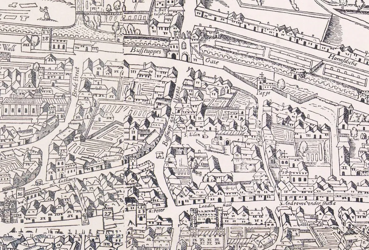
Civitas Londinum - our oldest printed map
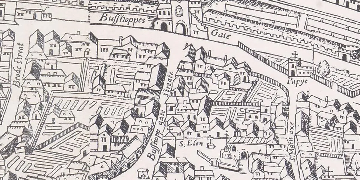
'Civitas Londinum' is one of the earliest printed maps of London, known to exist in only three copies (the others being held in the National Archives and at the Pepys Library in Cambridge)
It shows the layout of Tudor London some time between 1561 and 1570; the exact date is uncertain and has to be surmised from the presence or absence of particular landmarks.
The map was printed in eight sheets, which do not fit together particularly well; the edges of the wood blocks appear to have been damaged at some stage. The map is drawn from a bird’s-eye perspective of the landscape, to a scale of roughly 28 inches to the mile.
The area shown here is around Bishopsgate – William Shakespeare’s first lodgings in London were in this area, and the map represents our closest picture of London as he knew it.
All three surviving copies were printed some time during the reign of James I (who came to the throne in 1603), as his arms were added to the original woodblocks (not shown on this sheet)
This is usually referred to as the ‘Agas map’ because it was attributed in the eighteenth century to the Elizabethan surveyor Ralph Agas (1545 to 1621). This is certainly erroneous, as Agas would have been too young to produce it, and it does not reflect his usually style.
See more images of Shakespeare from our collections
Shakespeare in pictures