

County Maps
Here we discuss county maps from the Metropolitan maps collection. Many of these can be viewed on the London Picture Archive (LPA), or where an alternative reference is given, then these can be viewed in the original by requesting through our catalogue.
Beginnings
Mapping of the counties first began in the early 1570s when Christopher Saxton was instructed to survey the whole of England and Wales. This was supported financially by Thomas Seckford, and he was soon producing printed maps of the individual counties. Amongst the earliest was a map of the County of Middlesex which represented in the collection by a facsimile reproduction (reference: SM/PM/CO/01/07/001). The maps vary in scale from county to county, but include features such as villages and towns, coastlines, rivers and some bridges; symbols and shading are used although there is the notable omission of any roads. In 1579 all 34 county maps by Saxton were published in a single atlas.
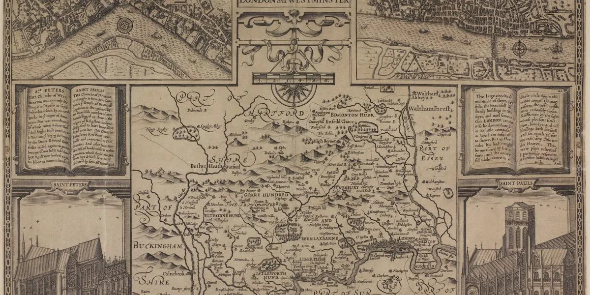
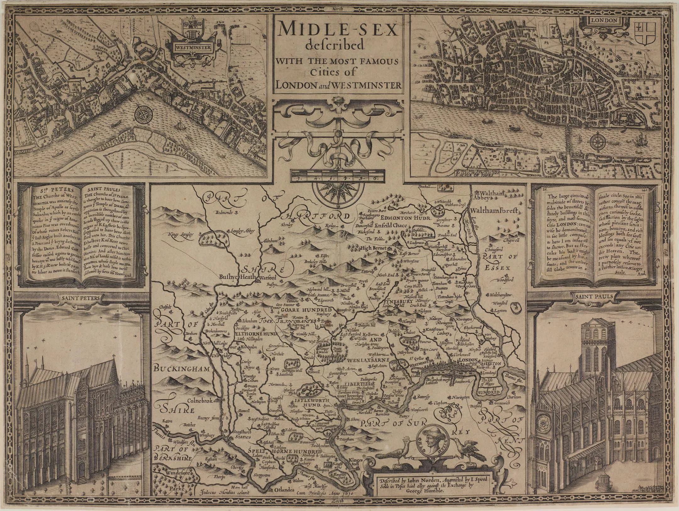
In 1590 an ambitious project was initiated by John Norden to produce a series of county maps accompanied by a written description of the areas being depicted to be known as 'Speculum Britanniae'. Unfortunately for Norden only two volumes were produced before his death in 1625, those for Middlesex and Hertfordshire, though he published some of the county maps independently. The maps include features omitted by Saxton including some roads. Saxton and Norden's maps formed the basis of the work of subsequent cartographers and publishers for many years. They were, for example, the basis for the maps included in William Camden's 'Britannia', first published in 1607 and 1610 (for the Middlesex example see reference: SC/PM/CO/01/07/006;) and also for the work of John Speed, who not only made some corrections and improvements, but also augmented the maps with an array of decorative features, which no doubt made them more commercially appealing.
The Middlesex map of John Norden, augmented by John Speed, was published 1610 and here the county map was accompanied with maps of the Cities of London and Westminster.
These early county maps continued to form the basis of works published throughout the seventeenth century, often with slight amendments or additions. For example, Philip Lea publishing in the 1690s added many roads to the Saxton maps; Robert Morden's county maps were composite of the earlier maps augmented by new information gained from the gentlemen of the counties (reference: SC/PM/CO/01/07/029 for Morden’s Middlesex). The relativity small scale and the large county areas being depicted necessarily limited detail with some maps showing only major features such as county boundaries and others attempting to delineate topographical features with hatching, shading or by using symbols.
County mapping in the seventeenth century
The 'Large English Atlas' published by Emmanuel Bowen and Thomas Kitchin was the first attempt to cover all the counties on a large scale in a uniform manner; they were published as early as 1749, though later re-prints were left largely unchanged. Examples in the collection include, reference: SC/PM/CO/01/07/045 for Middlesex which shows boundary lines of the Hundreds, reference: SC/PM/CO/01/06/007, a facsimile edition of the map of Kent which was adorned with inset engravings of the exterior of Canterbury and Rochester Cathedrals, and reference: SC/PM/CO/01/08/008 which shows the county of Surrey.
In the mid to late 1700s new surveys began to be carried out producing some outstanding maps. John Rocque began to produce a series of exceptionally detailed large-scale county maps showing selected buildings and detailing land use by highlighting woods, parks, marsh, grass and farmland. Similarly the map of the County of Essex by John Chapman and Peter Andre published in 1777 provided the most detailed and accurate map of the area at that time showing not only major roads and towns, but also features such as bridges and turnpikes, houses, parks, open spaces, creeks and quays (see reference: SC/PM/CO/01/04/007 and SC/GL/CAE/002).
County mapping was an expansive undertaking. The usual manner of financing large scale surveying and printing of maps was to invite subscriptions from the local nobility, gentry and other wealthy householders; often in return the map would carry a dedication or the coats of arms of those who had contributed or perhaps their names and houses would be engraved into the map. An exceptional example of this is Warburton's Map of Middlesex from the early 1720s which includes several hundred coats of arms in a decorative border (see reference: SC/PM/CO/01/07/034). Relying on funding from individual private financial sources was unreliable and risky. The attempt to Thomas Jeffreys in the 1760s to produce large scale county maps most likely led to his bankruptcy in 1766, despite being hitherto one of the most commercially successful cartographers of the era.
Nineteenth-century developments
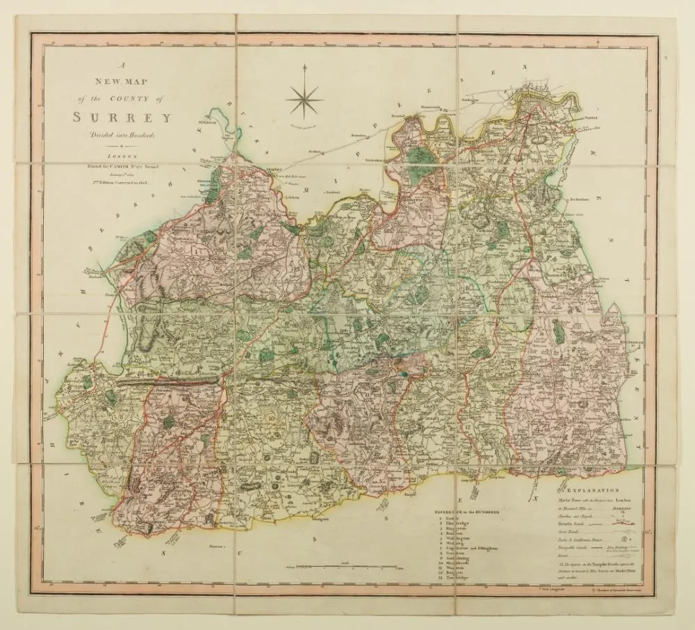
The early 1800s saw new (or revised editions) of County maps being published. For example, Charles Smith published his New English Atlas in 1804, and his map of the County of Surrey can be seen at LPA 330525; and John Cary published a similar undertaking in 1809 and his map of Middlesex can be found at (reference: SC/PM/CO/01/07/062). Many other map-makers also joined the competitive area of publishing county maps and many examples can be found in the collections such as a map of Surrey published by Joseph Lindley and William Crosley in 1819 (LPA 330561) and a map of Huntingdonshire engraved by Thomas Foot from 1824 (LPA 330573).
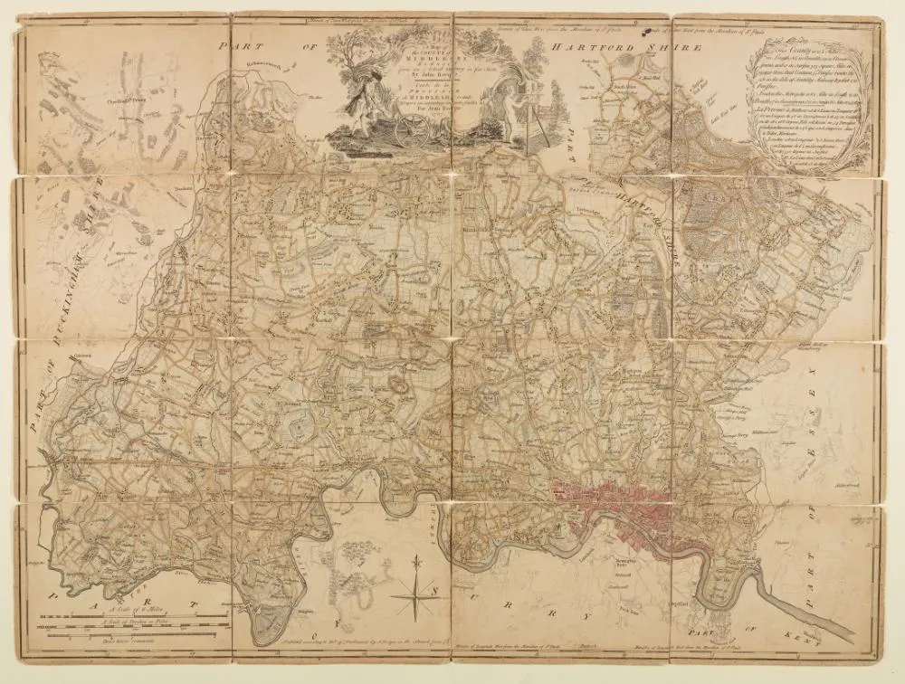
However, the most ambitious project at this time was planned by Charles and John Greenwood. The brothers aimed to produce newly surveyed large-scale maps of the whole country, eventually completing all 33 English and four Welsh Counties; the maps were formed into their 'Atlas of the Counties of England' which published in parts between 1829 and 1834. An example of their map of Middlesex is in the collection at reference: SC/PM/CO/01/07/074, and as with all their maps provides an exceptionally detailed picture of the area at the time.
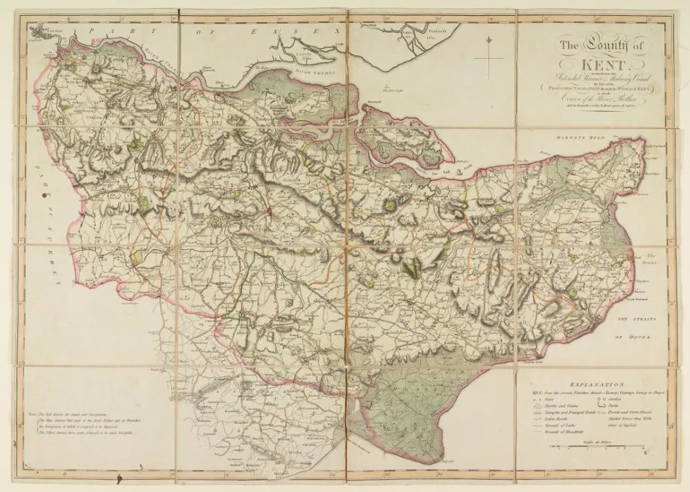
The Greenwoods represent the last major attempt by individual commercial mapmakers to attempt to map all the country. Subsequently such large-scale county mapping mostly relied on the work of the Ordnance Survey. Inaugurated in 1791, the survey began publishing maps of county areas from 1801 and unlike figures such as Jeffreys and the Greenwoods did not rely on private financial backing. There still, however, remained a demand for maps of countries particularly those conveying specific information; for example, following the Reform Act of 1832 parliamentary boundaries and polling places are often illustrated. Maps were also published to show major changes to proposed infrastructure such as intended canals and railways; for example, the c.1800 map sold by William Faden of the County of Kent was amended to show the proposed Thames and Medway Canal and its navigation through the Weald of Kent (LPA 330504); and J and C Walker's map of Middlesex published in the latter part of the 1800s illustrating the intended Western railway line (see reference: SC/PM/CO/01/07/091).
Want more maps?
You can register for a History Card and then you can request to view more maps to your heart's content in the Archive Study Area! To whet your appetite there are some facsimile maps available to browse in the Information Area map drawers from the 1500s to late 1900s!
Register for a History CardSearch the catalogue
Try using keywords to search maps of certain geographical areas on our catalogue and once registered, you can request to view them.
Search the catalogue