

Netball and sandwiches
Here we take a look at one of London’s earliest recreational spaces, the ‘unofficial park’ that is Lincoln’s Inn Fields.
Lincoln's Inn Fields
Lincoln's Inn Fields is recognised as the largest public square in London and has been enjoyed by Londoners for more than five centuries. As with Moorfields it developed from three open fields held in private ownership. These fields gradually took on the guise of a public resource. In 1617 the Society of Lincoln’s Inn, together with representatives of the neighbouring parishes, presented a petition for the formalising of the access already enjoyed by local people, and obtained leave to create 'walkes, after the same manner as Morefields' for the benefit of 'general commoditie, and health'.
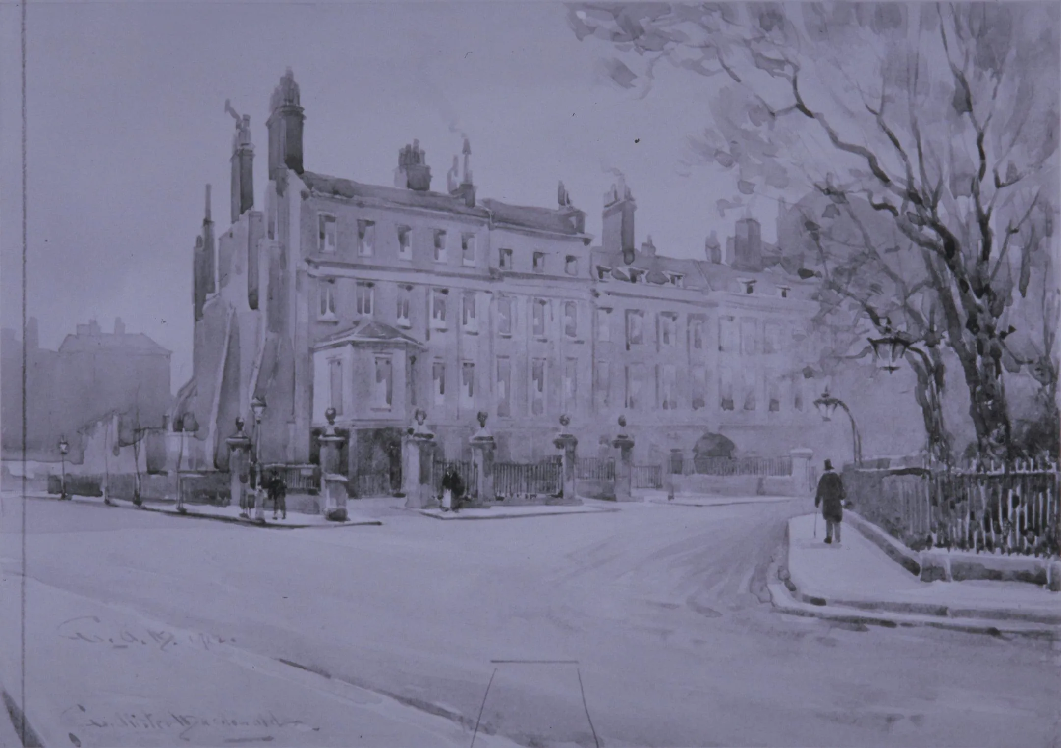
While public access might at first sight appear to be an egalitarian and enlightened gesture, it is clear that for the affluent residents and growing community of lawyers it was the spacious grandeur and air that marked the fields apart from the crowded streets further east. From 1640 fine houses surrounded the perimeter fronting the wide-open space. People strolled, groups gathered, militia groups practised drill and horses were exercised. But there was also fly tipping and robbery, with a corresponding increase in controls and regulations.
Post 1666
Following the Great Fire of 1666 the fields became a designated place of storage for the household effects of displaced citizens. Protection from the Autumn weather was rudimentary but round the clock security was provided by volunteer militiamen. In the wake of post-fire building there came a proposal to build a church, to be called St Mary in the Fields. Two drawings exist for the church, ascribed to no less than Christopher Wren (one now held at All Souls, Oxford and a variant design featuring a dome, at City of Westminster Archives) and these show a fabulous building that would have dominated the space, significantly larger than any church planned for the City of London.
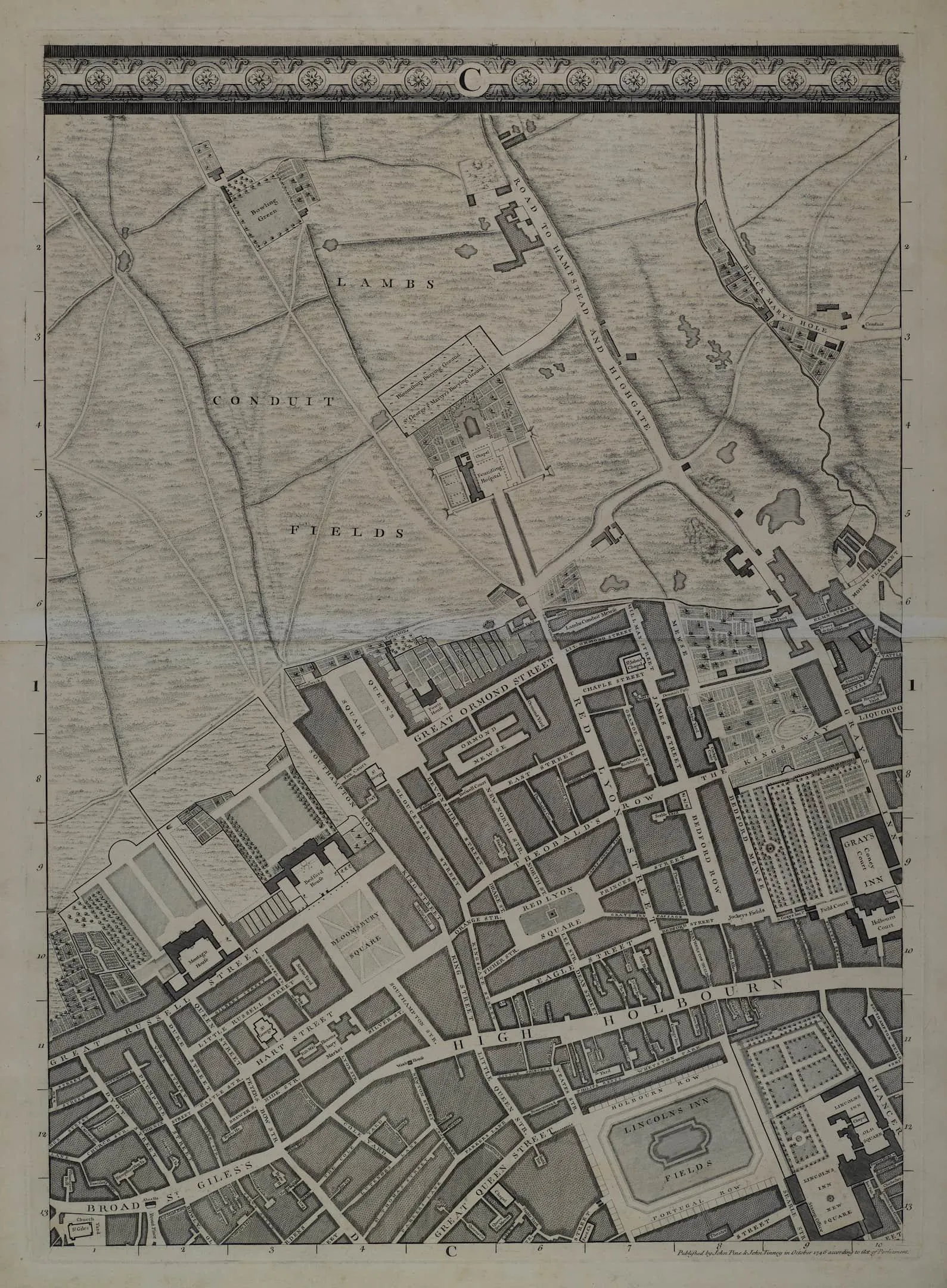
But the fields remained uncovered, more paths were built, and constables were appointed to keep order. Gradually access to the open space became much more restricted, and in the mid-eighteenth century a huge basin of water was placed at the centre of the fields, enhancing the grandeur and formality of this increasingly exclusive space which can be seen in John Rocque's map of the area in 1746.
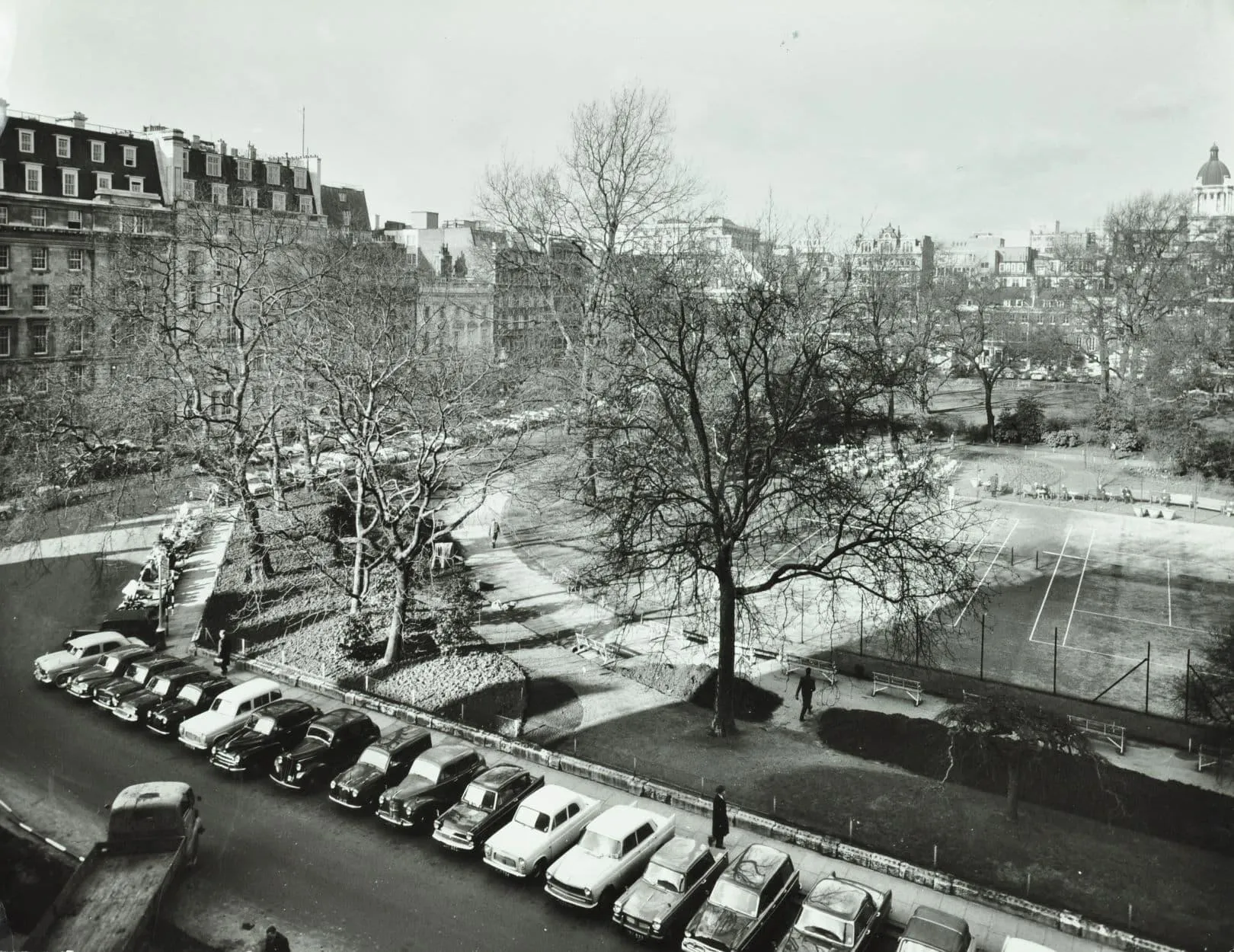
The nineteenth century and beyond
The TLA collection becomes key to tracing the development of the site in the later nineteenth century with the full documentation of the story to take the fields into public ownership - for public recreation, open to all.
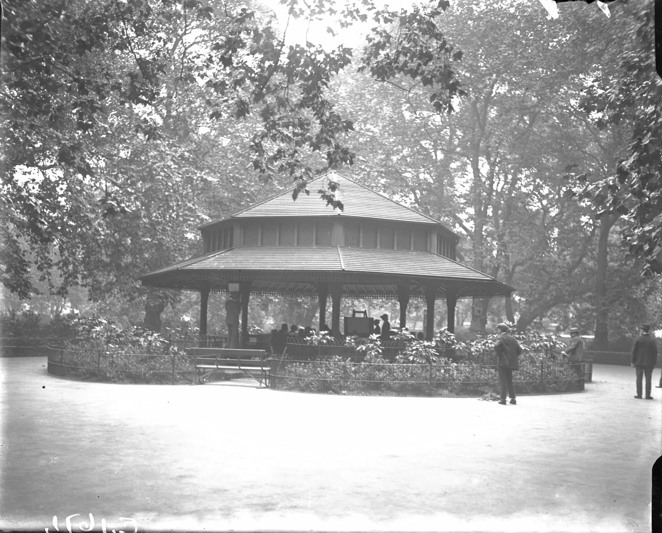
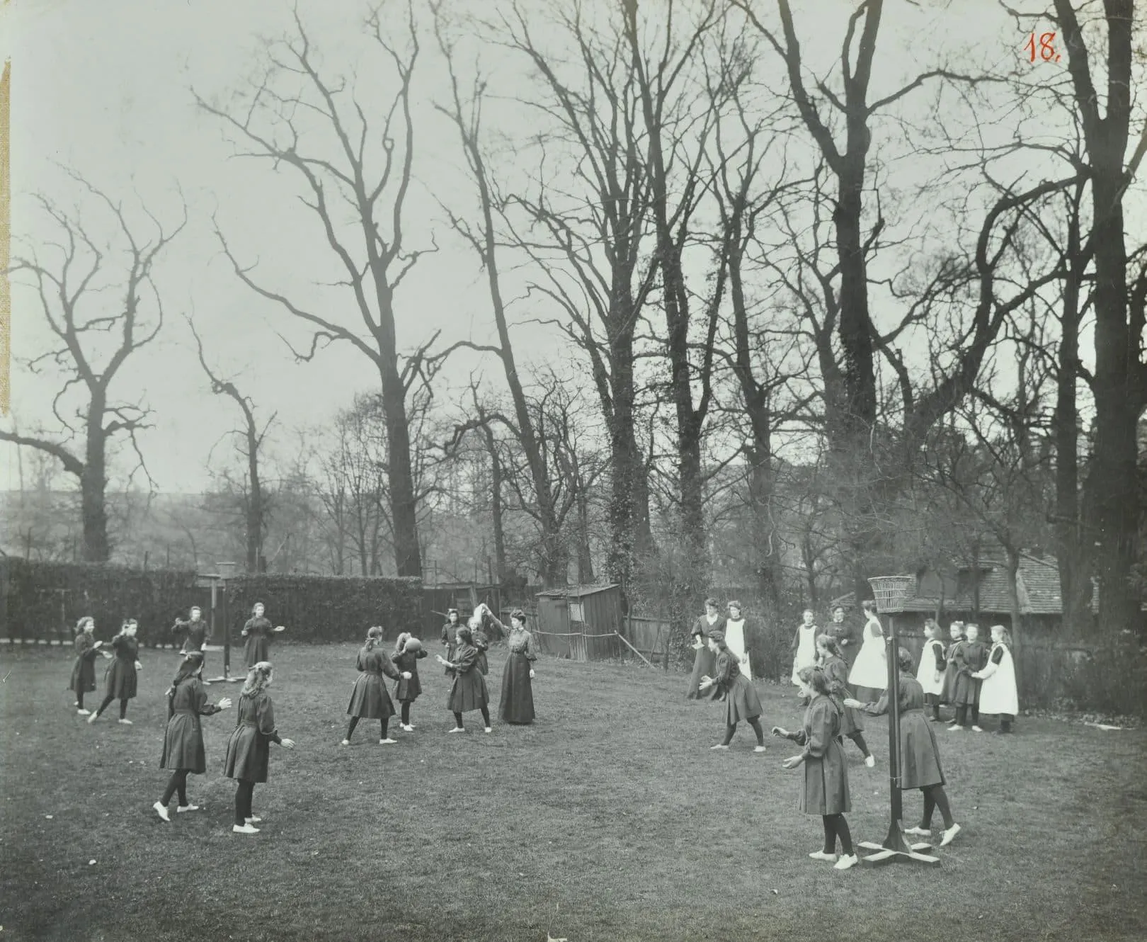
The Metropolitan Public Gardens Association and Metropolitan Board of Works, and later the London County Council, ran determined campaigns, succeeding only in 1894 when the Parks Department of the London County Council was able to get going on the provision of a central bandstand (with very well attended lunchtime concerts), tennis courts and netball courts. These became extremely popular amongst local workers and students; sometimes for exercise, but mostly as an enjoyable spectacle while packed lunches were consumed.
Management of the Fields passed to the London Borough of Camden in 1970. Sandwich eating and the sporting tradition continue unabated at Lincoln’s Inn Fields.
Search the London Picture Archive
You can find more images relating to Lincoln's Inn Fields on the London Picture Archive.
Search the London Picture Archive